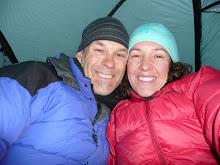
After leaving the comforts of our plush hotel room in Breckenridge we headed out about 9:30am.
We had our 2nd highest divide crossing today Boreas Pass 3,500mtrs, although the climb was about 15km long we had a very gentle grade of climb as the road we were on used to be an old railway track back at the start of the century so the going was good, saw another red fox on the way up - it was obviously used to seeing people as it just wondered down the road in front of Jo & she even managed to stop & get a photo of it.
After a really nice downhill from the top of Boreas pass we came to a town called Como which we decided to stop for lunch as it had a shop & we could not pass up a cold drink to go with our bagels, but unfortunately the shop had a 'Back at 2pm' sign on the door (maybe they had gone home to watch some Oprah?) so we just had to eat our bagels & drink our water instead.
After leaving Como we started biking into huge open fields - these had been old ranches that somebody had vision of becoming lifestyle subdivisions but they never eventuated into anything - just lots of lovely named roads, they had even created playgrounds & baseball diamonds in the middle of nowhere that were now all over grown - seemed a little eerie!!
Afternoon thunderstorms have been forecasted for the next week & as we were riding along the black clouds started rolling in & then the thunder & lightening started - that was quite a show in front of us - but we were riding right into it so it did start to get a little too close for comfort.
They take Lightening strikes very seriously over here especially when you are high up in the hills, alot of trail heads even have posters informing people of what to do if in a thunderstorm!
Lucky for us we managed to ride around the edge of the storm that was in front of us & just got caught in a down pour from the edge of it.
We arrived in a town called Hastel which showed on the maps & guide book that there was actually no camping spots in town - so after talking to the nice man at the service station we decided we would just carry on down the road & find a spot on the side of the road (out of view) for the night - which we did successfully , just as we got the tent up the rain came down - more thunder & lightening all around us , this continued most of the night.
DISTANCE: 84km
AVERAGE: 16.8km
RIDE TIME: 4.59hrs
ASCEND: 720mtrs
Thursday, September 17, 2009
Subscribe to:
Post Comments (Atom)


No comments:
Post a Comment